Hiking in Northern Black Forest
The Black Forest (the map to the right s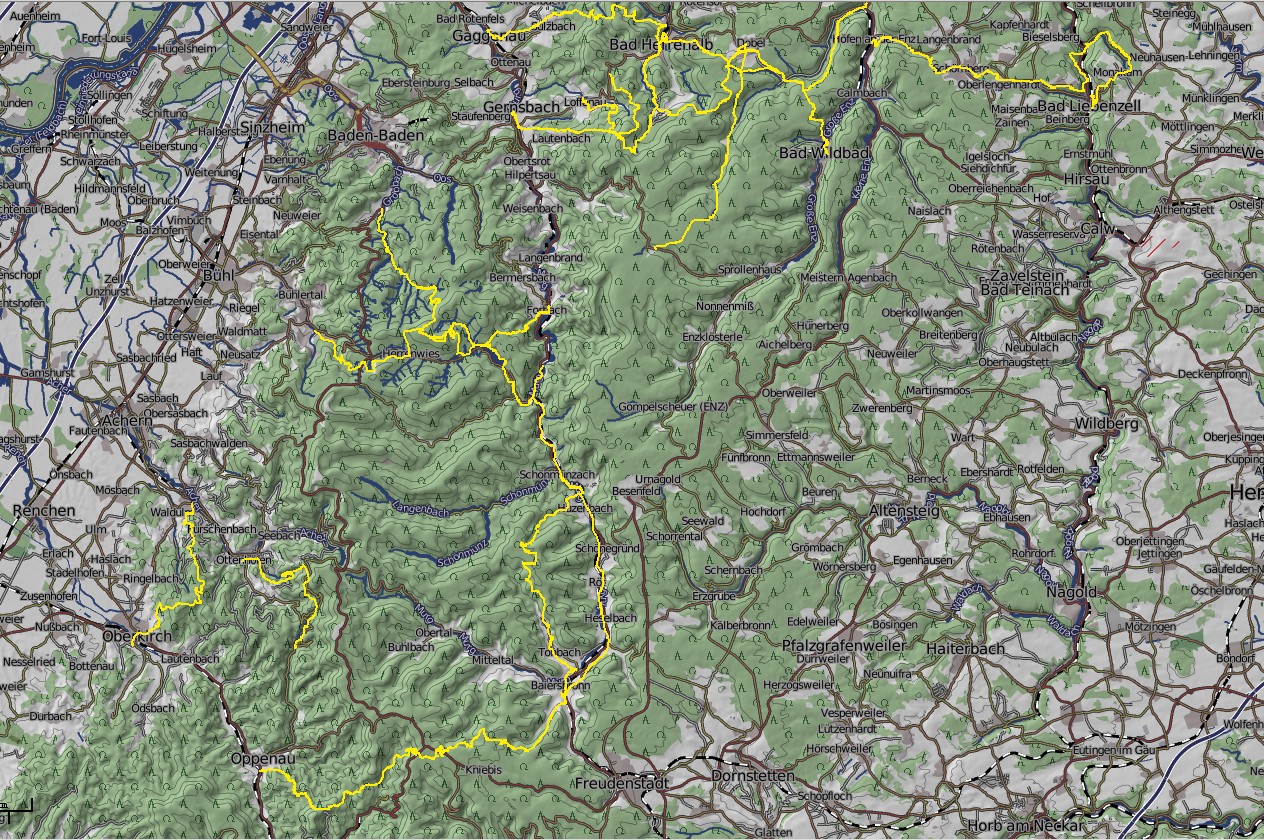 hows the northern part as an overview of the tracks on this page. The map is based on OSM data and originates from here) is a mountain range that extends over more than 150 km. It's called "black" because the covering forest mainly consists of conifers. It's northern tip point is Karlsruhe's Turmberg. With the Black Forest at its southern gates, Karlsruhe has in its southern vicinity a region with a climate totally different from the city's: there's considerably more precipitation (up to three times as much as in Karlsruhe) and it's notably colder there. Therefore the Black Forest offers winter tourism resorts and summer heat vanishing points for the population of the Rhine valley. Long winters and heavily raging storms surely had a strong influence on the emergence of the specific Black Forest culture, which among other elements consists of an emphasis on traditional religion (even more so in the southern Black Forest) and craftwork. The famous cuckoo clocks originated in the Black Forest and - as any other craftwork - as long as there was no strict social labor division were a typical product of the long winter months when the weather prevented any productive work outside the house. Contrast this wild nature and grim autumn and winter weather with another trademark phenomenon of the Black Forest: picturesque and elegant towns offering up-price tourism addressing more the elderly people, often including a health-resort. Baden-Baden may be the original and largest and best-known of such cities, but it is not the only one: Bad Herrenalb, Bad Wildbad, Bad Liebenzell, Sankt Blasien to name just a few are such spots where this specific Black Forest type of "between village and world"-culture blooms. Characteristic for the western edge of the northern part of the Black Forest is a line of rims created by the local bedrock sequence, which feeds a number of - often cascading - waterfalls. All over Black Forest (but the larger ones are more to the south) there are lakes of glacial origin and the south in parts is dominated by wild canyons that are deep and wide enough to have separated the population on both sides sufficiently so that one can even today clearly hear differences in the dialect of both sides.
Tracks
| From Loffenau to Käppele | GPX | 11 km | 7/5 |
| From Bad Herrenalb to Bad Wildbad | GPX | 22 km | 9/8 |
| From Höfen to Bad Liebenzell | GPX | 30 km | 13/13 |
| From Kaltenbronn to Bad Herrenalb | GPX | 23 km | 6/11 |
| From Bad Herrenalb to Gaggenau | GPX | 18 km | 7/9 |
| From Enzbrücke to Bad Herrenalb | GPX | 18 km | 9/9 |
| From Bühlertal to Forbach | GPX | 16 - 23 km | 10/10 |
| From Kappelrodeck to Oberkirch | GPX | 15 km | 7/7 |
| From Ottenhöfen to Oppenau | GPX | 20 km | 12/12 |
| From Schönmünzach to Baiersbronn | GPX | 20 km | 8/7 |
| From Gernsbach to Bad Herrenalb (Devil's Mill) | GPX | 16 km | 10/8 |
| From Oppenau to Baiersbronn | GPX | 30 km | 18/16 |
| From Forbach to Geroldsau (Baden-Baden) | GPX | 23 km | 11/11 |
| From Kaltenbronn to Bad Wildbad | GPX | 14 km | 2/6 |
| From Raumünzach to Baden-Baden | GPX | 25 km | 9/11 |
| From Forbach to Unterstmatt (Westweg 3) | GPX | 21 km | 12/6 |
| From Unterstmatt to Alexanderschanze (Westweg 4) | GPX | 28 km | 9/9 |
| From Bad Wildbad to Forbach | GPX | 21 km | 8/9 |
| From Sand to Schönmünzach | GPX | 19 km | 6/10 |
| Around Baden-Baden | GPX | 11 km | 8/3 |
| From Sand to Mummelsee | GPX | 15 km | 6/4 |
| From Gengenbach to Offenburg | GPX | 14 km | 4/4 |
| Hoher Ochsenkopf | GPX | 22 km | 11/11 |
Descriptions
From Loffenau to Käppele
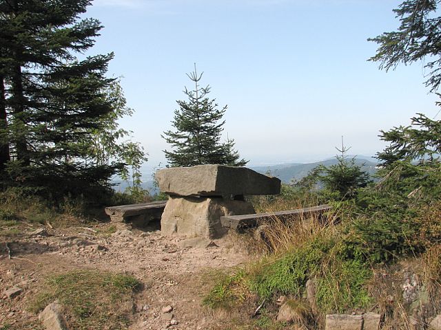
The destination of this tour is the Teufelsmühle (Devil's Mill) and to pass a number of clear view spots when ascending. There is another track leading over Devil's Mill, see below.
Clear view: 5/5
Nature: 2/5
Culture: 1/5
From Bad Herrenalb to Bad Wildbad

This tour is rather nice and recreational than spectacular.
Clear view: 3/5
Nature: 1/5
Culture: 3/5
From Höfen to Bad Liebenzell
The route starts with an at least 20 minutes  soft incline ad does not have specific POIs until Castle Liebenzell. The castle itself, however, is in good shape and includes a restaurant with a terrace with a very nice view, which one can even improve by climbing the tower. After the castle one has to descend for about three kilometers down to the valley of the Nagold. Having crossed the Nagold, the entrance to the valley of the Monbach lies ahead. This valley almost appears to be an installation. The water is cascading down over rocks which are often entirely covered with moss all the way. Where the first half of the route has been a lonesome trail, here it is crowded. On hot days you'll have to queue up to pass the creek at narrow passages, as water and trees keep temperature here considerably below the values of the surroundings. The route leads on up to a hillside opposing the hill of the castle and finally descends down to Bad Liebenzell, which is worth taking a final walk around.
Clear view: 3/5
Nature: 5/5
Culture: 4/5
From Kaltenbronn to Bad Herrenalb
The starting point is about 700 m high above 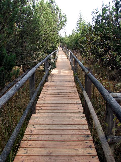 the tram stations of Hilpertsau on one side and Bad Wildbad on the other side. Kaltenbronn is a pass between the valleys of Murg and Enz. First the route approximately sticks to that elevation level and leads to the first sight a highmoor that includes a small, dark, a bit dangerous looking lake, the "Wildsee". A narrow, wooden footbridge leads through the moor. After the moor, the trail leads down, always accompanied by a small creek until the "Große Wiese" ("great meadow"), where the valley opens up. Here there would be the chance to turn left and walk back to Kaltenbronn on a more western path. Walking more or less straight on, one has to ascend again to reach Dobel. Dobel is a nice village which is situated too high that could be reached by a tram. For many trails it is a good place to have a break in a cafe, especially if you're walking in the colder times of the year. After Dobel, walk down to Bad Herrenalb.
Clear view: 1/5
Nature: 4/5
Culture: 2/5
From Bad Herrenalb to Gaggenau
Right outside and above Bad Herrenalb one can stand on the Falkenstein rock and look down to the valley of the Alb. The trail leads on, passing clear view points from time to time, and the "Mauzenstein" a rock which looks as if some giant had forgotten a pillow. Before the path leads down again to Gaggenau, it passes the "Bernstein", a rock that appears to be made to improve the fantastic clear view over the Murg and even Rhine valley further.
Clear view: 5/5
Nature: 2/5
Culture: 2/5
From Enzbrücke to Bad Herrenalb
Another tour between the valleys of Alb and Enz.
Clear view: 2/5
Nature: 1/5
Culture: 2/5
From Bühlertal to Forbach or Raumünzach
The first part of the route leads along 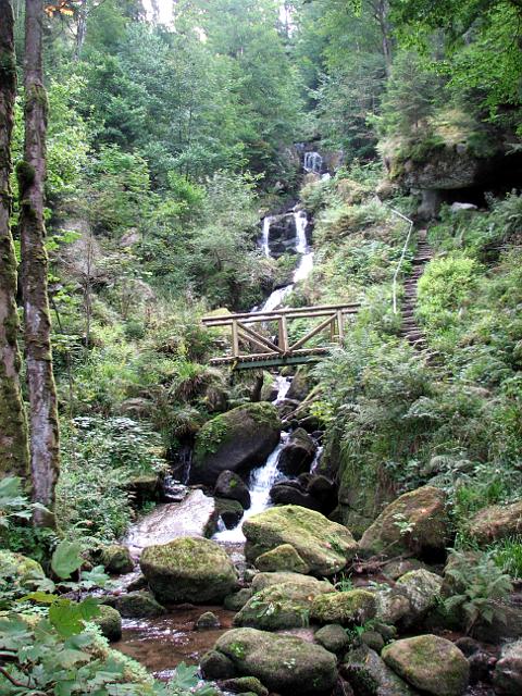 the Gertelbach, a small creek that continues to cascade ever steeper over little waterfalls downward, while the trail over small footbridges and adventurous stairs leads upwards until the way crosses the "Schwarzwaldhochstraße". Then the elevation level stays more or less the same, until - after passing the "Mehliskopf" - in Herrenwies one has to decide, if one wants to climb up to the "Badener Höhe" and "Herrenwieser See" or to stay down in the valley (passing the "Herrenwieser Schwallung", something that was needed for the Dutch to create their colonial empire, for a more detailed explanation see the info board there). The alternatives meet again shortly ahead of the western tip of the "Schwarzenbach-Stausee". We proceed at the northern bank of the lake to avoid the street on the other side. At some point one can turn left to directly walk to Forbach, but we stay at the lake's shore and reach the dam. Here one can take a bus or walk down to the tram station of Raumünzach.
Clear view: 4/5
Nature: 5/5
Culture: 2/5
From Kappelrodeck to Oberkirch
Kappelrodeck the starting point is a nice Black Forest village. One has to climb quite a few meters right at the beginning and further on, until one has passed Blaubronn, a remote hamlet on a green saddle point, but there's still some altitude left to be climbed. Only on about 700 m the tip of the tour is reached and we start descending towards the Schauenburg, which is an impressive ruin above Oberkirch.
Clear view 3/5
Nature: 3/5
Culture: 3/5
From Ottenhöfen to Oppenau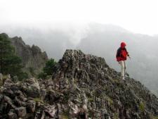
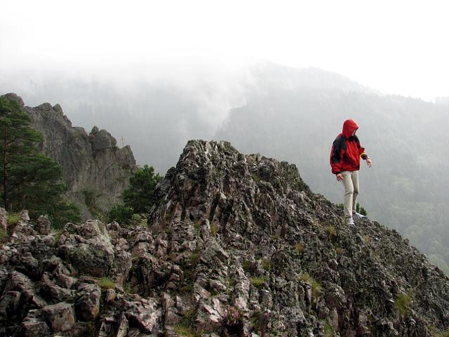
This trail is probably one of those densest covered with POIs of all kinds. Parts have also been described by Mark Twain in "A tramp abroad". Having arrived by tram via Achern, it might happen that you can continue to Ottenhöfen with a historic steam train. The one km or so one has to walk in Ottenhöfen shows the village as a nice one. Then pass a lumber mill and enter the Gottschläg valley. It's another valley with a small creek and many picturesque small waterfalls. One of them, the "Edelfrauengrab" ("Grave of a noble lady") is linked with a dramatic myth of an evil noble lady dying an even more evil death. Having left the Gottschlägtal one ascends about one kilometer to the Karlsruhe Ridge, which is called like this as a number of citizens from Karlsruhe died here during a short while. The ridge is adventurous to walk and gives a fine clear view over the valley. The ridge is 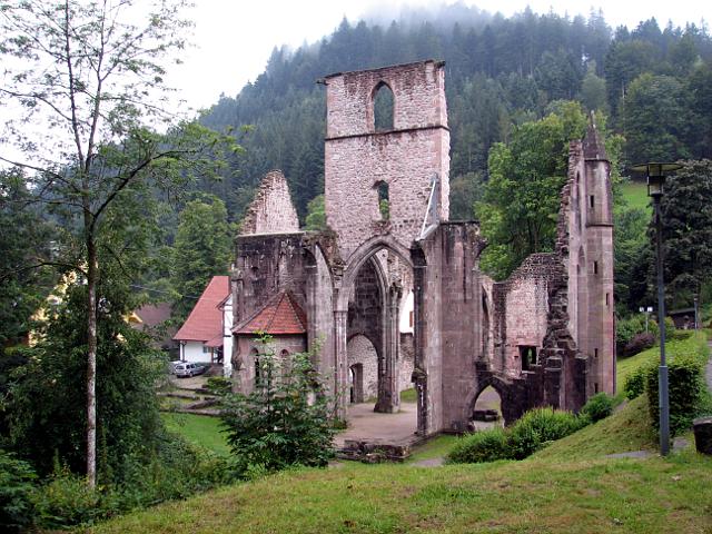 followed by the bad middle piece of the trail. One has to walk some kilometers along the Schwarzwaldhochstraße, which is abused frequently by bikers as a race track. I've not yet found an alternative to this. Finally one reaches the branching point, where one can leave the road again and immediately starts going down towards the ruins of the monastery Allerheiligen. Quote Mark Twain: "all of a sudden the dense curtain of the forest parted and we looked down into a deep and beautiful gorge and out over a wide panorama of wooded mountains with their summits shining in the sun and their glade-furrowed sides dimmed with purple shade. The gorge under our feet—called Allerheiligen—afforded room in the grassy level at its head for a cozy and delightful human nest, shut away from the world and its botherations" and that's how it still is. Next to the ruins there is a restaurant, which usually is very welcome at that time of the tour. Proceeding there follows the second string of
  waterfalls of the day. Again Mark Twain: "It is beautiful—a mixture of sylvan loveliness and craggy wildness. A limpid torrent goes whistling down the glen, and toward the foot of it winds through a narrow cleft between lofty precipices and hurls itself over a succession of falls. After one passes the last of these he has a backward glimpse at the falls which is very pleasing—they rise in a seven-stepped stairway of foamy and glittering cascades, and make a picture which is as charming as it is unusual." and that's how it still is. At the end of the myth-soaken waterfalls of Allerheiligen there's a bus station. Take care, the last bus runs rather early. The other option would be to walk the remaining 7.5 km to Oppenau. Mark Twain claims that his pedometer had measured 146 miles from Allerheiligen to Oppenau which had taken him 11.5 hours to walk, while his guide book and maps say 10.25 miles. Actuall from the bus station at the lower end of the glen to Oppenau it's 7.5 km which one can accomplish in one and a half hour, as it's mainly downhill and the valley of the Lierbach is worth this effort.
Clear view 4/5
Nature 5/5
Culture 4/5
From Schönmünzach to Baiersbronn
Starting in Schönmünzach - 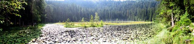 another beautiful Black Forest village - the trip begins with a steep incline up the silver mountain. At an altitude of almost 800 m, there's the Huzenbacher Lake, which has an enchanted appeal, as it is more than half overgrown. Ascending 100 more meters one is granted a view back on the lake from above. The path leads on on about constant altitude until the forest opens and gives free a view down the valley of Baiersbronn, which is world-renowned for its gastronomy. What remains is to walk down the valley to the tram station of Baiersbronn.
Clear view 4/5
Nature 4/5
Culture 3/5
From Gernsbach to Bad Herrenalb (Devil's Mill)
This track starts in Gernsbach about 160 m above 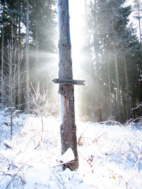 sea level, climbs to the Devil's Mill (which includes a restaurant) on 900 m and goes down again to Bad Herrenalb on about 360 m. So this tour with 700 m elevation difference isn't easy. When climbing upward there's almost permanently a perfect view over the Rhine valley. We did the tour as after some grey winter days weather forecast announced a perfect winter day for the weekend. So in office we've quickly decided to use the day outside and do this tour. And the weather forecast didn't lie at all. It was an absolutely clear and cold winter day with fresh snow lying on green grass and the weather sides of rocks and towers. The restaurant on the Devil's Mill (the peak) is very welcome on such a cold day, just as is the "Klosterscheuer" in Bad Herrenalb to warm-up again. When descending one will stumble over a number of faces on the trees of the forest, which look particularly funny, when halfly covered with snow.T he starting and end point of the tour are comfortably connected to Karlsruhe's Market Place by tram trains S4 and S1.
Clear view 5/5
Nature 2/5 (however, on a winter's day, one can not expect many flowers :) )
Culture 2/5
From Oppenau to Baiersbronn
This track is as arduous as it holds diversified 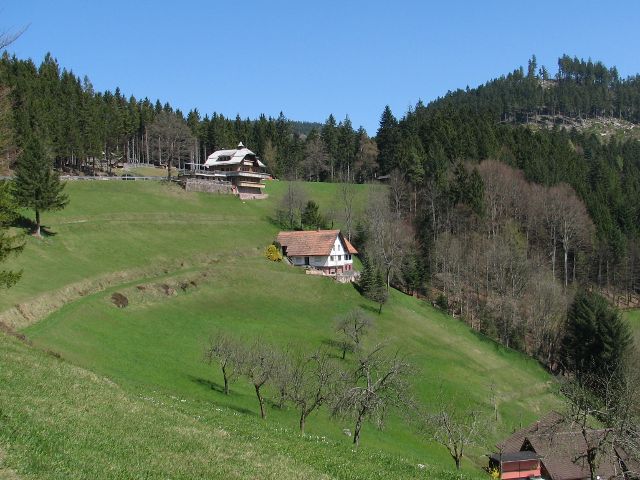 impressions. The starting town Oppenau iles on only about 250 m. While it is located well in the Black Forest, it is still "facing"west toward the larger cities of the Rhine valley. It leads over the 900 m high Alexanderschanze to Baiersbronn, which - while it is in the valley of the Murg, it is already close to the creeks and rivers feeding the Neckar. The tour begins with a rather steep inline out of Oppenheim but just for a few 100 m. After that the path still climbs, but softer and wavily until after about 7 more km it reaches the Renchtalhütte, a restaurant built in a somewhat classical Black Forest style. From the terrace of the hut one has a wide view over the valley of the Wilde Rench. On the opposing hillside the hotel Dollenberg with the two star restaurant Le Pavillon self-consciously claims a major share of the hill. After the rest the way leads down into the valley, just to rise again immediately after it has crossed the creek. The following slope is a south-western one, which easily heats up in sunshine, even if it is an early spring sunshine. It has a rough appearence with many stumps and sere trees. It seems to have suffered much from storm Lothar in 1999. Nowadays with its dense grass, bushes and small trees and its obviously comparable high average temperature it is home to many insects, probably also small saurians and maybe even snakes. At the upper end of the slope the Alexanderschanze waits. It is passed by ahe regional street B500, better known as Schwarzwaldhochstraße, which is abused as race track by bikers as vehicle drivers alike. However, some distance away from the street the Alexanderschanze is a good place
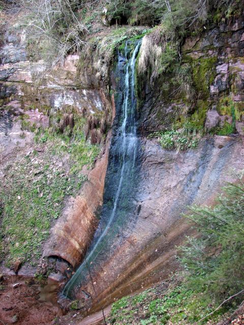 for another rest, as it offers various good views. From here one is going downhill again. And as this time it is a northern slope in March or April one might find some remaining snow fields between the trees, while one still feels the sweat in the back from the arduous and warm way up to Alexanderschanze. The following steep descent is done in a zig zag style, which is followed by one more or less flat km, before on the left there is the Ellbachsee, a small lake with a mystic atmosphere, which comes from it being captured between steep slopes on most sides and that it is halfly overgrown such that the opposite coastline cannot be spotted. Many frogs live here, which cannot be overheard. After the lake the path leads onward for a last time. This time, it's just an additional elevation of 100 m, but with all the way gone so far, it may appear not so easy at all. After having reached almost 900 mabove sea level once more, it becomes a bit difficult to not lose orientation, before one quite suddenly stand before the Sankenbach water falls which probably everyone will consider to be the main highlight of the tour. There is a basin at the top of the water falls, which fills slowly with the most of the year only little water that is running there. The water can be released by lifting a small lock to create for a short time a much more impressive view of the waterfalls. One should be two or more persons to do some nice pics of this, as the water will always be faster than the lock lifter. From the water falls the path leads along another lake (either right or left, both is possible) and one follows the Sankenbach down to Baiersbronn with easy steps.
Clear view: 4/5
Nature: 4/5
Culture: 2/5
From Forbach to Geroldsau (Baden-Baden)
Just as the tour Oppenau - Baiersbronn above 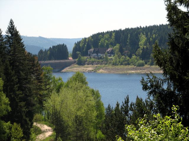 this one runs from one part of Black Forest (Murgtal) to a different one and crosses quite different areas. Arriving from Karlsruhe by train in Forbach one might be astonished that after the valley of the Murg has already been very narrow on one or two passages that there is the space at all for a town like Forbach, which at some time seems to have decided to demonstrate its pride by building a church which seems to be slightly oversized for a town of 5000 people. The first task of the tour is to walk from Forbach up to the Schwarzenbachsee, a resrvoir 400 m above Forbach. The effort is rewarded by a rest at a hut which has been errected at just the right spot with a great view over the lake. The second part adds just about the same number of elevation meters, which lead first to another, however much smaller lake the
 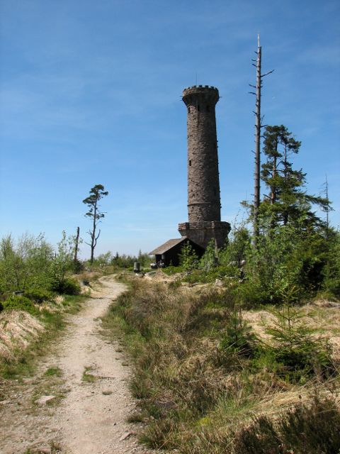 Herrenwieser See, which can easily be walked around to stay on one level for some time, as after that a steep path leads to the Seekopf, an immediate neighbor summit of the Badener Höhe. A path through interesting rough vegetation leads almost flat to the Badener Höhe itself, which is 1005 m high and has a 30 m high tower rising from its very top. At latest from the top of the tower one has a 360° clear view over Black Forest and the Rhine Valley. From now on there is only one direction: downward, and while the tour by plain distance km may seem to be only of medium arduousness , but descending these 800 m will tire everyone at least a bit. On the long way down one can see numerous creeks uniting one after the other to an ever stronger stream to which one comes very close in a flatter terrain to follow it strictly at its bank under notedly cooling trees. No matter how tired the hiker might have become to this point these meters are entertaining enough to completely forget about the tired feet. Finally the forest opens for the Bütthof, which is a final chance for another rest (the Bütthof is a rest
 aurant) then the way leads on similar as before, but with more flowers at the side (rhododendrons). The creek becomes wilder and the valley narrower and and more rocky. Just at a part which is a it wider there is the Geroldsauer Water Fall. Probably it's not the most impressive of the water falls of the region, but the overall composition of the spot gives a nice atmosphere - and on hot days a comfortably cool one as well. From there it is only a few steps to the first houses of Geroldsau. In principle to be satisfying one feels that Baden-Baden - including a walk along the whole famous Lichtentaler Allee - would be the "correct" destination, especially for people coming from far away to the region, for as the reputation and popularity of the city of Baden-Baden grows with the distance from it. However, from here to Baden-Baden one would have to walk along a very unpleasing street. So, it's better to use the bus, either to the center of Baden-Baden or to the upper end of Lichtentaler Allee.
Clear view: 5/5
Nature: 4/5
Culture: 3/5
From Kaltenbronn to Bad Wildbad
Kaltenbronn is a good starting point for a  number of tours. As for the tour to Bad Herrenalb (see above) we arrive via tram (to Gernsbach) and a bus. This time, however, it was winter. Well, almost, the winter in Karlsruhe already had retreated mostly. So it was a bit of a surprise that there wasn't the slightest sign of snow melt at Kaltenbronn. All the trees were still full of snow as if the temperature had been well below zero permanently for weeks. The first to pass was a group of deer sitting around on the snow just as in July seemingly not caring least about the seasons. We then once more walked across the wooden path through the moor and along the small lake (hidden under ice and snow). Lots of branches under the weight of the snow grabbed down to the path and tried to block the way. Soon after the moor the way departs from the one to Bad Herrenalb and we were walking towards Bad Wildbad. First, however to the Grünhütte (Green Hut). While along the
 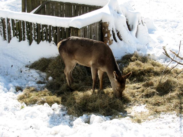 way we did not meet many people the Grünhütte was crowded as it is a restaurant. After two hours in the cold the Heidelbeerpfannkuchen is welcomed, even by people who would normally think of it as being a bit heavy. The Grünhütte is not even half the way to Bad Wildbad and so the rest should not be expanded too long. When we arrived at the Sommerberg (Summer Hill) above Bad Wildbad there was a kids' skiing race, not only downhill, but the yougsters had to do a number of rounds downhill AND uphill. It looked really exhausting. Finally down in Bad Wildbad along the shore of the Enz creek the feet already stepped across snow free ground. Nevertheless a warming coffee and a cake (no shortage on that in Bad Wildbad) fitted well to this perfect winter's day.
Clear view: 3/5
Nature: 4/5
Culture: 2/5
From Raumünzach to Baden-Baden
Raumünzach, the starting point, is a station of the S4,  but is it more than a station? Actually I never quite undersood why there is a station and how it came to receive a name for there is missing a village, just a single house (has it always been used as station house?). Maybe it is because here the Schwarzenbach („black creek“) steeply meets the Murg creek. Some hundred meters above the Schwarzenbach is dammed up and there is a hydro generating station, a hotel, a famous bike route and a rather easy way to cross the main ridge of the Black Forest by following the Schwarzenbach. So obviously this corner is not only of interest for hikers.The Murg valley is narrow here which means nothing else than that on the first two km we have to climb 200 meters. Soon thereafter we find ourselves at the foot of the
  dam.Stairs lead up to the shore level and the next two km lead easily along the shore of the artificial lake.From the lake it is not far to the Rote Lache, a restaurant with a great view. It was lively there with hikers and bikers and of course we used the chance for a lunch break. Having left Rote Lache the way was green, relaxing, but honestly slightly lenghty until Merkur came into view (about 15 km). Merkur is the Hausberg of Baden-Baden. German cities sometimes have a „Hausberg“ (home mountain). For example the Königstuhl is the Hausberg of Heidelberg and the Schauinsland is the Hausberg of Freiburg. A Hausberg always is very close to the city, normally its foot is covered with the city's housing.
 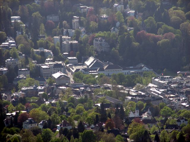 It never can compete for the title of being the highest or largest or greates mountain of the country. It is not covered by glaciers, but usually there is a great view especially considering the rather limited elevation of the Hausberg. It is more a crossbreed of a living room with a mountain. It is almost as comfortable as a living room and only slightly more ardous o go to a Hausberg than to the living room. This fact implies that a Hausberg always houses a decent gastronomy. Merkur cannot be overlooked as on top of it Baden-Baden has built a look-out. It would not have been necessary to see Baden-Baden, as this is possible from nearly every seat of the restaurant, but it helps a lot for an overview of the North Western part of Black Forest. After having walked for more than 15 km from Rote Lache through seemingly remote territory (in fact it is of course not really remote, the economic usage just does not require permanent presence of people) it appears now surreal to look to Baden-Baden and see in one single perspective the theatre and the opera with a history of famous artists, the museums, the legendary casino and the city itself which has been and still is in so close relationship with all kinds of media and arts and be it that it was yelled at there.
Clear view: 5/5
Nature: 4/5
Culture: 3/5
From Forbach to Unterstmatt (3rd leg of Westweg)
 This track partly overlaps with Raumünzach—Baden-Baden and as it is the third leg of the Westweg there are many descriptions available on the web. It sets out in Forbach in the Murg valley. Forbach is easily accessible by train from Karlsruhe at an elevation of only 300 m above sea level. Out of Forbach we rise up to almost 800 meters along only 4 km, which are mostly within forest. From Wegscheid we descend again toward the Schwarzenbach lake. Above the lake (shortly after the 5 km mark of the track) there is a hut with a good sight of the lake – a good opportunity for a first rest. Now outside the forest the track leads flat along the lakeside and then turns for the Badener Höhe. On the way to this flat summit there is another, much smaller lake, the Herrenwiesersee and the Seekopf, a summit, which can almost not be distinguished from the Badener Höhe, as the saddle between them is almost at the same elevation. So it is a flat path on the last some hundred meters towards the tower on top of the Badener Höhe. From the tower one can see very well what still lies ahead for the rest of the day. The way down is again enclosed by forest
 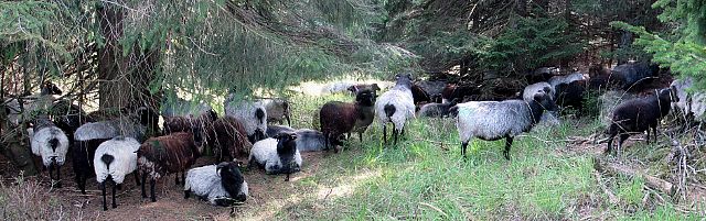 until all of a sudden we find ourselves at a racetrack – pardon, a road. The B500 is a rather nasty companion for the next two km between Sand and Hundseck. Where it departs maybe the most interesting part concerning landscape of this day begins, the ascent to and the descent from Hochkopf, which – while less known – actually is slightly higher than the Badener Höhe and also a flat summit partially covered by wood. From there it is only a short way down to our quarters in Unterstmatt. Unterstmatt is an outpost rather than a village, which obviously owes its existence to winter tourism. Summer business is done with bikers and hikers. As the former ones typically disappear before dusk the number of beds which is assessed for winter easily accommodates the hikers on the Westweg.
Clear view: 4/5
Nature: 4/5
Culture: 2/5
From Unterstmatt to Alexanderschanze (4th leg of the Westweg)
This is the fourth leg of the Westweg. Within  one day one passes the highest peaks of Northern Black Forest and reaches Central Black Forest. Leaving Unterstmatt immediately the ascent to the Hornisgrinde begins over its North-Eastern side. Creeks plash down lively in their moss-covered beds and offer a pleasant sight at the early morning. After 2 km we pass the Ochsenstall, which is a housing that would have allowed to shorten this day's tour on cost of the previous one. Then the steepest part of the way up to the Hornisgrinde begins, which at the end is no longer in the forest. Right before the top plateau we have to pass the antenna tower on Hornisgrinde which can be seen from a far. With all the warning signs around it, it is one of the more uncomfortable situations on Westweg. The top plateau has been freed of its forest centuries ago by grazing
 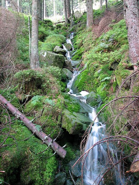 cattle, sheep, and goats. Nowadays no one would take their livestock up here anymore to feed them, but to maintain the historically grown landscape it is still done. The descent from Hornisgrinde is steep and ends directly at the shore of the Mummelsee. The Mummelsee is a very famous destination for one-day trips from the region. It is no exaggeration to say that it is crowded there. It is actually that crowded that the Mummelsee has become a hotspot of motor bike accidents. What a contrast compared to the peak plateau where we have been just 20 minuites ago. There is a huge hotel, which was recently built a new as the preceding one burnt down. So here there would be another potential place to stay over-night. The next five kilometers the track characteristics stay constant. The path is rather flat and more or less parallel to B 500 and with a good sight to the right over some minor hills and the Rhine valley. Along we pass Seibelseck, another quarters which exists for winter tourism, but which offers its service all year long. This part ends about at the Darmstädter Hütte – another chance to eat or for accommodation. Afterwards the sight opens to
 ![]() the left resp. to the East, as we pass the Seekopf on its eastern side. At the foot of the Seekopf there is the Wildsee. We could spot some campers at its shore, who must have had a tough night, considering the storm which woke even us in our masoned housing. Behind the Wildsee the sequence of hills seems to have no end to the East. Shortly thereafter the way starts to lead down to the Ruhestein, again a winter tourism spot. But this one is really well frequented in
the left resp. to the East, as we pass the Seekopf on its eastern side. At the foot of the Seekopf there is the Wildsee. We could spot some campers at its shore, who must have had a tough night, considering the storm which woke even us in our masoned housing. Behind the Wildsee the sequence of hills seems to have no end to the East. Shortly thereafter the way starts to lead down to the Ruhestein, again a winter tourism spot. But this one is really well frequented in 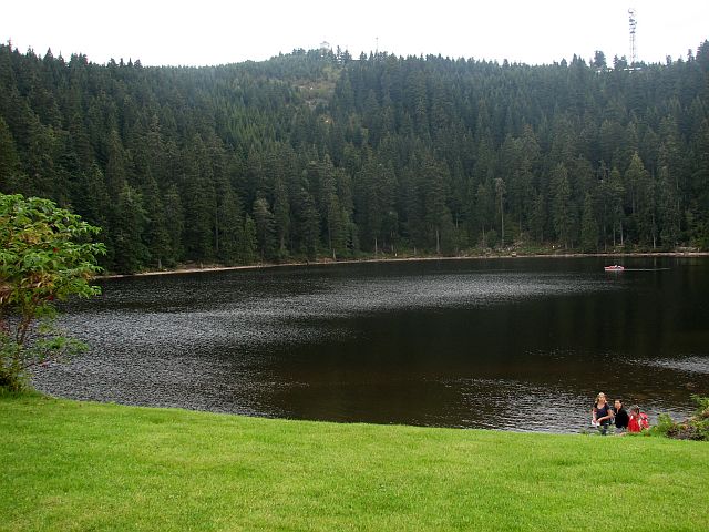 summer-times and we take our lunch there as it is about mid-way for this day. After the break the path led us up again to the main ridge of Northern Black Forest.We have been walking along it most of the day, but from here to the end of the day it was almost always aparent that it is the main ridge: one could look often far to the West as well as the East. On the Schliffkopf there would have been another chance for a lunch break, just by turning left for some meters, yet taking this chance would imply to leave a lot of money there. Shortly behind the Schliffkopf the trail crosses
  a region which was heavily affected by the storm Lothar which struck in 1999. We had to hurry up now as the sky was darkening more and more and the rain which was announced for all of the day finally seemed to approach. As high as we were walking we could watch the weather change early and therefore managed to reach the Alexanderschanze before the rain started. The Alexanderschanze is listed in many overviews of the Westweg as potential accommodation, which would be very helpful if it actually was, as no other housing is close by and as the last bus runs early, but it is not. With the sky as dark as it was now and the rain pouring down heavily, this abandoned house gave us more a Rocky Horror Picture Show impression while we were waiting for the bus. Finally the bus arrived and we got quickly back home via Freudenstadt and with the S4.
Clear view: 4/5
Nature: 4/5
Culture: 2/5
From Bad Wildbad to Forbach
We begin cheating. From the station in Bad 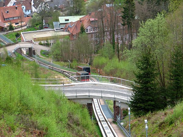 Wildbad a funicular – the Sommerbergbahn – runs up 260 m high and 630 m far and in two minutes we have reached the plateau – almost plateau – of the Sommerberg. The mountain station has a viewing platform from which one oversees the valley of the Enz and – of course – the funicular. We leave the station and immediately enter the forest which we proceed through for about 5 km almost without any slope. It is something like a hikers' highway. With the Grünhütte (green hut) – being the
 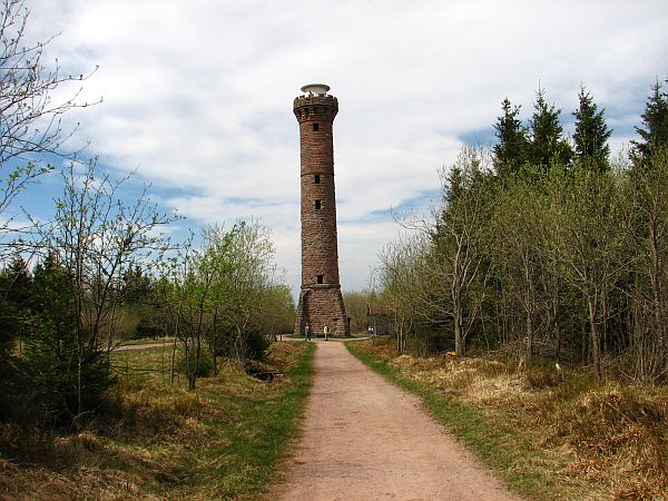 destination. It would be too much to say that it is crowded there, but still it is lively and the hut has quite some seating capacity to accommodate two to three times as many people as are here now. After a lunch which was heavier than the trail so far we leave the Grünhütte towards the Wildseemoor, a highmoor - “you never walk alone”, it is even more of a hiking highway than before. The path through the moor passes a lake in the middle and ends not far from Kaltenbronn. From now on we follow the second leg of the Westweg. The next hill – Hohloh - on the route is
 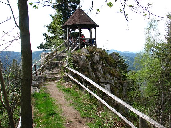 slightly higher but equally flat. From Kaltenbronn it is not far to go for the plateau. The path leads straight to the lake on this hill and turns right there towards a tower. From that tower one has a really great view of the Northern Black Forest, over the Rhine valley and to the Vosges. Slowly now the path starts to turn downhill, first almost unnoticed, but it ends with a 4 km long descend with an average 13 percent grade which ends only within Forbach. The Latschigfelsen above Forbach has been roofed with a pavilion From there one still has parts of the view as from the Hohloh tower, but also a good sight of the Murg valley.
Clear view: 4/5
Nature: 3/5
Culture: 2/5
From Sand to Schönmünzach
This is a tour which connects on rarely 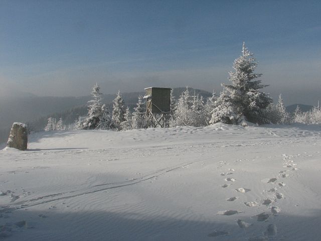 walked but marked paths Westweg and Murgtal. Starting point is the chapel of Sand. Sand is not much more than this chapel at an intersection and a bus stop in Black Forest above Bühlertal and below Mehliskopf where for our purpose the bus stop is the essential property of Sand. While in Karlsruhe all snow already was gone –although it had been cold enough – here winter still ruled firmly. Our first direction is upward to the top of Mehliskopf. For a few meters we have to walk parallel to the ski slope, the piste was crowded, but we were the only two hikers. Clearly those preferring to walk up a hill instead of sliding it down are a minority. The next destination is Hundsbach, a small, scattered village in its eponymous valley.
 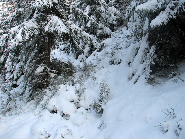 After lunch, which we took in Hundsbach’s “Forelle”, our today’s main exercise was awaiting. The way up to the Schurmhöhe sets out on a wide, straight road which was free of snow, soon turned into a still wide and winding path with not so much snow and gradually changed to a narrow and steep path which was hidden both under snow and in the forest that without the markers and without the track on our devices we simply had not believed that it actually is the path. The about one km long heart-piece of the climb took us about 30 minutes. We were the first to leave (human) foot traces in the snow. From the Schurmhöhe one has a good view down on the Schurmsee and to the opposite site of the Murgtal and in Western direction (among others)
 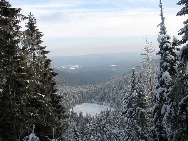 to the Hornisgrinde. That day Black Forest actually was a Black&White Forest. If the more pessimistic ideas of climate change become real we will have this only 15 to 20 more years at winter times – or each year for half a year. The snow reliably caught all of our carelessly long strides down the steep grade towards the edge of the Schurmsee which we therefore quickly reached on a bow surpassing the steepest flank. Standing there we realized that it is not only from above that the lake bears remarkable similarity with its neighbor the Hutzenbacher See. From there to Schönmünzach it is just four more km which go with ease until we actually reached the asphalt of the settlement where we faced the most slippery part of the day.
Clear view: 3/5
Nature: 4/5
Culture: 1/5
Around Baden-Baden
This tour leads over some of the hills 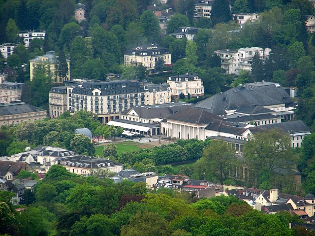 enclosing Baden-Baden. Starting point is the Große Dollenstraße. The first destination is the Altes Schloss – the ruin of Baden-Baden's Old Castle. From there one has a good view over the center of Baden-Baden. The next destination is the Battert, the first peak on the way. It shares some similarity with the rocks in Palatinate Forest and the Northern Vosges. On the way to Merkur we pass castle Ebersteinburg. There is a restaurant, but we were there before it opened. So check the opening hours if you plan to have a break there. On the way to the saddle between Ebersteinburg and Merkur one can get an idea of the future of the automobile if one looks out. The way up to Merkur – on its back side, with regard to Baden-Baden – includes some steep passages but as a whole is not difficult. On the top there is the
 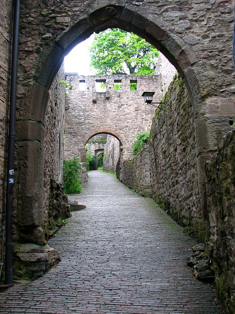 station for the cableway (nearly) down to Baden-Baden, a restaurant and a tower from which one can have a view over a large part of Northern Black Forest. Most people, however, go to Merkur to see Baden-Baden to their feet. The city which is a mystery. It seems that the further one goes away from it, the more popular it is. In the city one can easily hear a dozen languages within half an hour. Particularly many Russians are attracted Baden-Baden while the Americans seem to prefer Heidelberg as their top destination in Germany's southwest. It might be people follow the traces of their writers. Mark Twain wrote highly about Heidelberg, while from Baden-Baden he could just remember that he was fooled and people were unfriendly. In many of Baden-Baden's restaurants up to today one tries to maintain that spirit and grant this historic and famous experience to today's travelers. Indeed, Germans do less phatic communication than Americans or the French and greet with a simple “Hallo”, where others add a “How are you?” or a “Ca va?” (in fact Germans don't understand such questions as phatic communication but as factual questions to which they have
  to answer honestly and in detail), yet even in Germany it is rare that when you've paid the bill you are sent out on the road without a “have a nice day” after having witnessed throughout the service a perfected art of not being polite without being impolite or that when you have been served a still frozen cake because the chef in the cafe is not able to operate the micro wave oven you are insulted instead that the waiter tries to excuse. In Baden-Baden this spirit described by Mark Twain is still alive. You have to experience it yourself in these modern, fancy cafes. Avoid the classic, traditional ones; it seems they have not read Twain, in fact they probably don't even freeze their cakes. Also the Russian writers did not all speak well of Baden-Baden, but in sum they have created nothing less than a myth which could not even be destroyed by the war and which nowadays to some extent has become reality – something like a self-fulfilling prophecy – with the high profile Burda museum.
Clear view: 3/5
Nature: 3/5
Culture: 3/5
From Sand to Mummelsee
From Sand – a very common starting place – 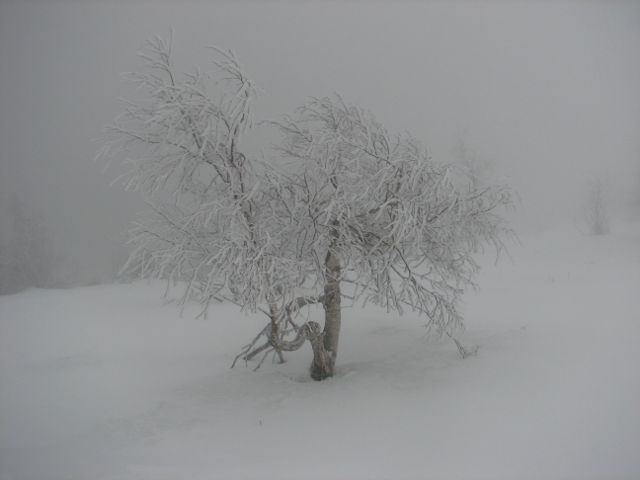 to Mummelsee – a very common destination – this tour leads partly over very common paths (Westweg), partly over – for Black Forest means – rather remote ways. Special on this day was the weather which allowed only to shoot photos showing mainly a small band of shades of light grey. Where at clear sight one has a view on Strasbourg from Hornisgrinde three was just fog into all directions and we might even have overlooked the large antennas if we hadn't known where they are. Nevertheless with the gastronomy at Hundseck, Unterstmatt, Ochsenkopf, and Mummelsee this is a very comfortable tour.
Clear view: ?/5
Nature: 4/5
Culture: 2/5
From Gengenbach to Offenburg
On that day we had a different plan, but 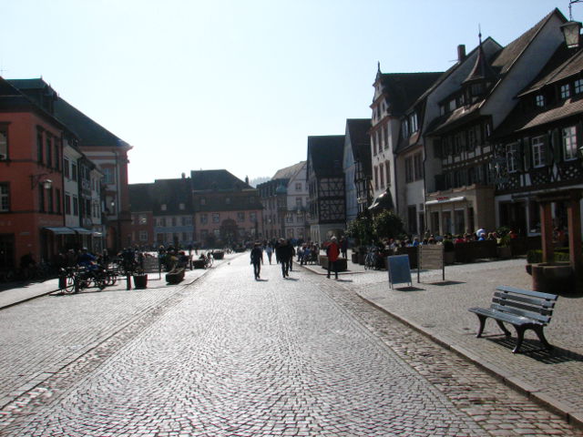 some other people chose to hike a bit on the rail tracks thus these were blocked and we missed our connecting train. Since I had Gengenbach for a long time in the back of my mind as starting or end point of a tour we reconsidered and – having lost a lot of time on the train – started with a lunch in Gengenbach. Gengenbach is a beautiful small city in Black Forest and the Kinzig valley which divides Northern from Southern Black Forest and it has some ambitious gastronomy
  as we understood. The we left Gengenbach northeast-bound to the hills. Most of the time on a wide path in a wood the trail leads first to Reichenbach and then over a small, but steep hill to Ohlsbach. Having passed Ohlsbach we step into vineyards. About one kilometer further the view opens to the impressive castle Ortenberg inmidst of a sea of grapevines. Having inspected the castle as far as it is possible – it hosts a youth hostel – we go down to the village of Ortenberg and from there a straight and unspectacular path parallel to some rail tracks to Offenburg station.
Clear view: 3/5
Nature: 3/5
Culture: 3/5
Hoher Ochsenkopf
As for a number of other tracks the starting 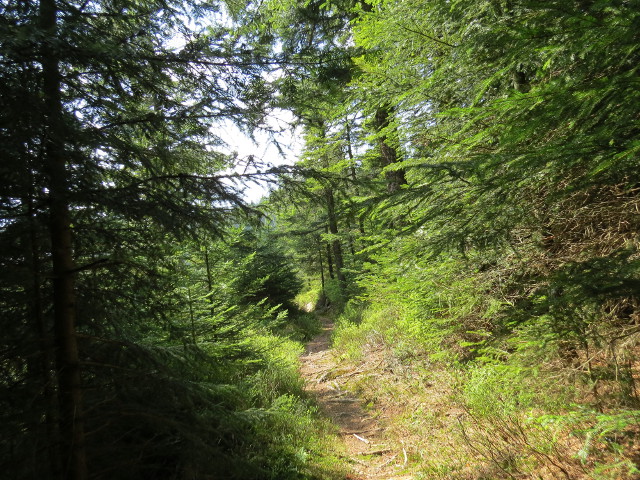 point is the stop of S41 at Raumünzach. This time we choose a way through the valley of the Schwarzenbach which ends beneath the Schwarzenbach dam. There we zigzag uphill to the water level of the barrier lake. We follow the shore line on the north eastern side of the lake – as on various other tracks. At the Herrenwieser Schwallung we break away from paths known to us and start climbing the Hoher Ochsenkopf. The Hoher Ochsenkopf is the core of the northern part
 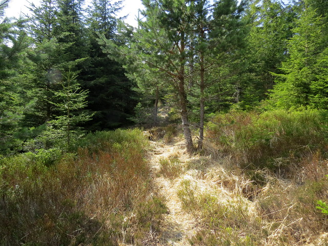 of the national park Northern Black Forest, the first national park in Baden-Württemberg. At first the path is wide, although covered with branches, but by and by it narrows down until doubt grows that maybe openstreetmap which served for the track planning could include non-existing links on this hill (all three pics here show pieces of the path). It will not take long and the vegetation will finish the job. So in fact this track might be
 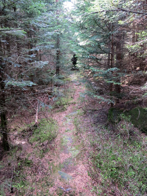 outdated after 2014 and openstreetmap could need an update. At a crossways in the forest where the path was still wide, so where you would expect it not, for two seconds we witnessed a heather cock fleeing from us, too quickly to take a picture and making tremendous noise when taking off. From the Hoher Ochsenkopf's peak at 1056 m the way down westbound is wider and will still thus still be available in three years (and probably beyond) and it is nearly straight for 3 km ending at Hundseck. From there we continue once more on a trail known to us along the Gertelbach water falls ending at the bus stop “Wiedenbach Parkplatz” in Bühlertal.
Clear view: 3/5
Nature: 4/5
Culture: 2/5