Hiking in the Palatinate Forest
The Palatinate Forest as a hiking resort is different from all other resorts in that it includes many huts where hikers can refresh with regional food and drinks. The huts usually are run by local clubs. The staff often works for the good of their club and only for very little or even no personal reward, therefore the prices are quite reasonable. The surface widely is covered with red rocks and thus characteristic and very recognizable.
Tracks
| Felsenwanderweg | www | up to 44 km | ? |
| From Maikammer to Neustadt | GPX | 16 km | 8/8 |
| Castle Spangenberg (Lambrecht) | GPX | 23 km | 11/11 |
| Around Trifels | GPX | 20 km | 12/12 |
| From Albersweiler to Siebeldingen | GPX | 19 km | 10/10 |
| From Siebeldingen to Bad Bergzabern | GPX | 21 km | 9/9 |
| From Bad Bergzabern to Wissembourg | GPX | 15 km | 4/4 |
| Around Dahn | GPX | 21 km | 10/10 |
| From Bad Dürkheim to Neustadt | GPX | 18 km | 5/5 |
| Around Weinbiet | GPX | 19 km | 8/8 |
Descriptions
Felsenwanderweg
The Felsenwanderweg (rock trail) is a 44 km 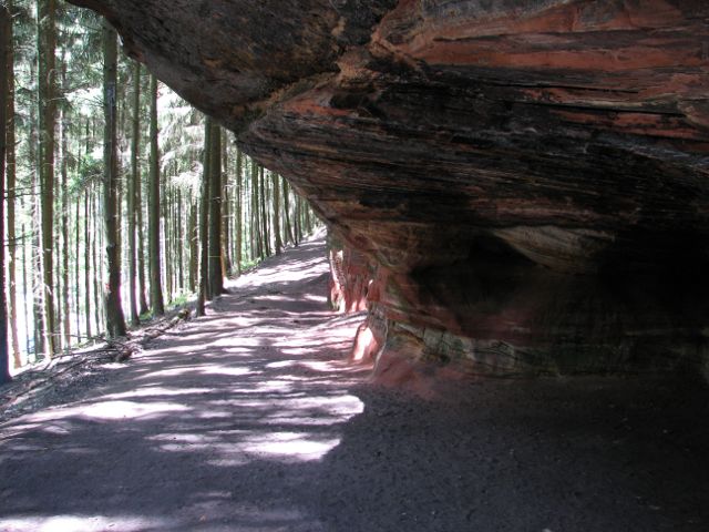 long trail around and above the Palatinate Forest town of Rodalben. A number of access paths connect town and trail. So it is not necessary to do the whole trip at once, but can decide conveniently each few km if it is enough for the day or if one wants to continue. A GPX track is not necessary, as it is almost impossible to leave the trail unintentionally. The third fact making a walk there comfortable is that the trail stays almost on one and the same level. Logging the path in the evening one might well be surprised how many km one has done. The trail has been established as around Rodalben the red sandstone rocks, which are the trademark of all of Palatinate Forest, are particularly impressive.
Clear view: 2/5
Nature: 4/5
Culture: 1/5
From Maikammer to Neustadt
Climbing up Kalmit, the highest hill of the Palatinate Forest. The trail ends in Neustadt, home to the "Elvetritsche".
Clear view: 3/5
Nature: 4/5
Culture: 2/5
Castle Spangenberg (Lambrecht)
This is more or less a typical Palatinate Fore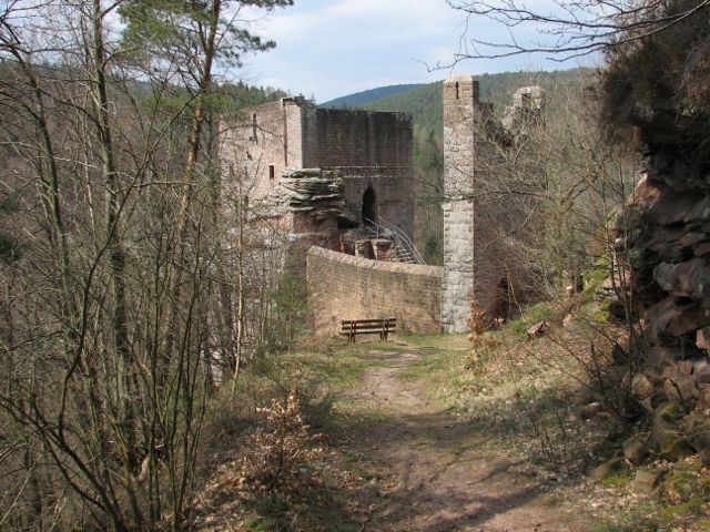 st tour. It includes two huts, of which at least one is a restaurant. The highlight is Castle Spangenberg (also including a restaurant), which is really nice and seems to have sprung right out of some old tale.
Clear view 3/5
Nature : 3/5
Culture: 3/5
Around Trifels
"Trifels" is one of the most famous castles of 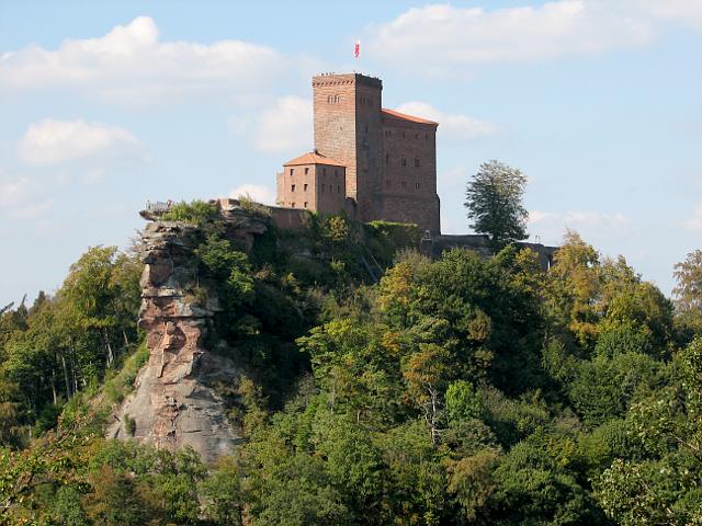 Germany. Once the Imperial Regalia were kept here and copies of some (Imperial Crown, Imperial Sword, Imperial Orb, and Imperial Sceptre) are still shown on Trifels today. Richard Lionheart was kept prisoner on Trifels for a few weeks. Many walking paths wind around Trifels. The one for download above is just an example.
Clear view: 4/5
Nature: 3/5
Culture: 4/5
From Albersweiler to Siebeldingen
This track might better just be called 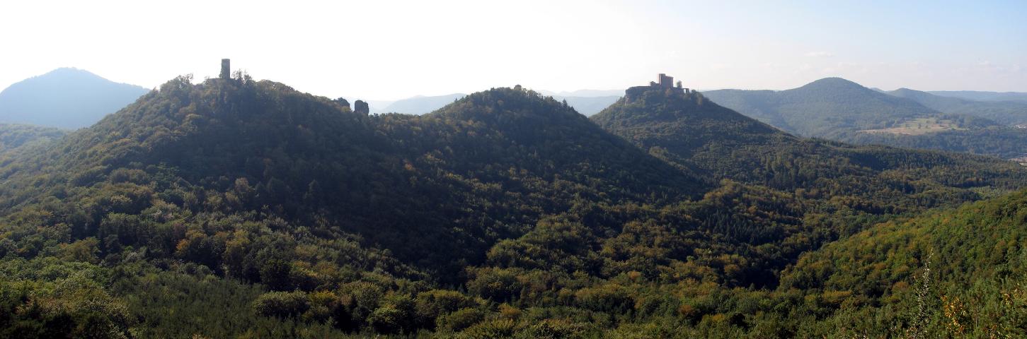 "Neuscharfeneck", as this ruin is the main POI on the track. But before one reaches the ruin, there is the often windy "Orensfels" from which there is a good view over the region. At this and a few other spots of the route one can see Trifels Castle. As on any hiking route through the Palatinate Forest, along the trail there are quite impressive rock formations here or there. Almost at the end of the tour one passes a wine grape research institute, rows on rows on rows of diverse wine grape sorts extend far into the surroundings.
Clear View: 4/5
Nature: 3/5
Culture: 4/5
From Siebeldingen to Bad Bergzabern
The tour starts in Siebeldingen near Annweiler, 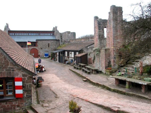 the village next to Trifels castle (see tour “Around Trifels”). Almost all the way leads along the edge between Palatinate Forest and Upper Rhine Plain. The way leads out of Siebeldingen through Birkweiler and Ranschbach to Leinsweiler, where it passes the Slevogthof named after and occupied by the impressionist painter Max Slevogt. Soon thereafter we start to ascend to the Madenburg, the main attraction of this day. The Madenburg is an extended rock castle from which one has a great view over the Rhine valley. A restaurant with simple but good local dishes is in operation. The Madenburg is located on top of an isolated hill. Consequently the path leads down about as much as it has lead upward before. Yet the next incline follows immediately and so we reach castle Landeck above Klingenmünster – another large castle. From there it is another two villages before we reach Bad Bergzabern which is worth a visit.
Clear view: 4/5
Nature: 3/5
Culture: 3/5
From Bad Bergzabern to Wissembourg
This tour links two cities which ha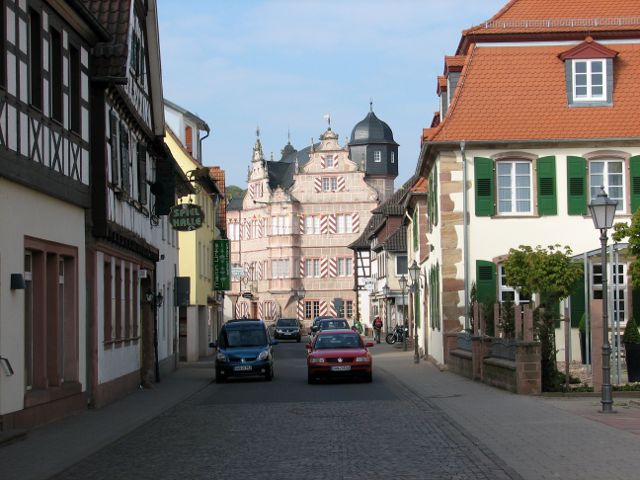 ve some things in common: both are cultivated – though each in its own way – and attract tourists, both host a terminal rail station as they are neighbored to a mountain range which is traversable for rail only at high cost, and both are about equally small (less than 10,000 inhabitants), but have some degree of centrality. However, they belong to two different nations and through most of the last millennium they were separated by some border. We leave Bad Bergzabern through the Kurpark after which immediately the first hills of the Pfälzerwald have to be climbed. Embedded in the hills is the village of Dörrenbach. Although it is very much at the edge of the Pfälzerwald like many other villages there you either live there or you come there purposeful in your leisure time, but you never pass by while being on the way from A to B. The houses in the center
 of Dörrenbach consistently are timbered and there is an interesting fortified church. We leave Dörrenbach via a steep incline and slowly descend again to pass the vilage of Oberrottenbach and to finally reach the village of Schweigen with the Deutsches Weintor (German Wine Gate), a building with the dimensions of the Brandenburg Gate, which appears to have slightly exaggerated size here on the countryside. The Weintor is a restaurant and has no function in the border traffic, however, it feels like a gate between Germany and France, because after the gate we turn right and left again and without noticing at first – the border sign has been overgrown – we pass the border to France. Only about 500 m after the border we reach the first housing of Wissembourg. Wissembourg's sight is shaped by
  the Lauter which passes Wissembourg as canalized creek, the timbered and other historic houses, and the Gothic cathedral. Therefore, while it is not so far from Bad Bergzabern to Wissembourg, at the end you surely will walk around some more kilometers in Wissembourg. The sequence of trails southbound along the Eastern edge of the Pfälzerwald (the Weinstraße) naturally ends here, but it has a sequel in the Vosges du Nord (see that page).
Clear view: 3/5
Nature: 3/5
Culture: 4/5
Around Dahn
This tour is a part of the 90 km long 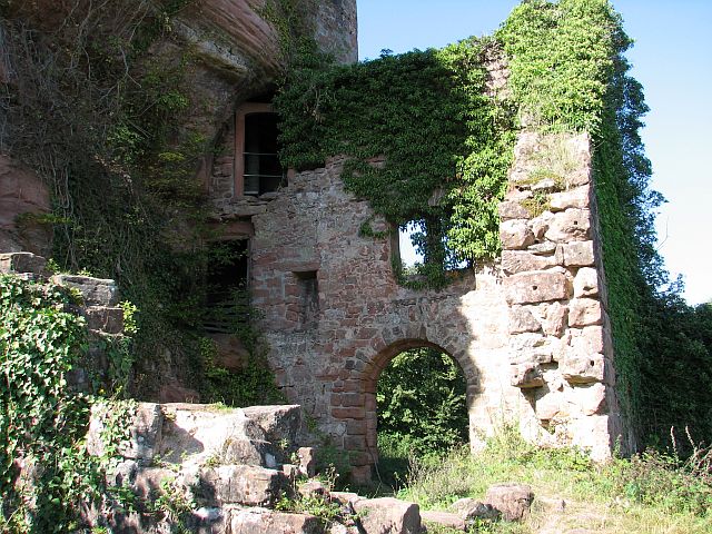 “Sagenweg“ (Legend Trail) in the Dahner Felsenland (Cliff Country Dahn). Very similar to the neighboring Northern Vosges the area is characterized by hills of moderate height but steep incline, distinctive red sandstone rocks, many ruins and a low population density which makes the settlements only sprinkles in the extended connected forest. Dahn is connected to the rail system via the Wieslauterbahn a single track branch from the tracks connecting Pirmasens and Landau. There are a few direct connections from and to Karlsruhe main station with a historic train (the “Esslinger”). The stations along the Wieslauterbahn are kept remarkably simple such that it is barely visible where exactly a train would stop until one actually knows it. We set out in Dahn, crossed the tracks and follow the trail signs. The path is zig-zagging upward to the first destination of the day, the Sängerfelsen, a rock from which one has a view over Dahn. From here it can be seen
 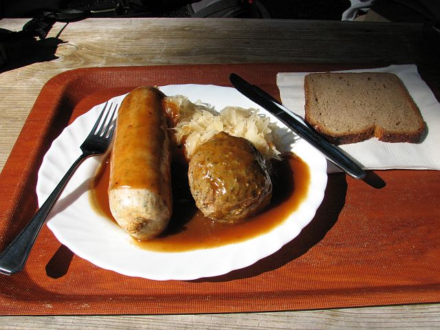 how Dahn like a collar bends around a rock, or a small hill, which is in its geometric center. In the following the trail leads northbound on the ridge to the ruin Neudahn. It takes some time to explore all of its still existing floors. Once we had found a way back out of the ruin we walked down the hill to the shore of a small lake which has attracted a larger lake of caravans. A few minutes later we reached the Dahner Hütte (Dahn Hut) right at lunch time. The traditional regional lunch (the legendary Saumagen) was a little too much and too heavy for the not so many km we had done so far such that we felt some resistance continuing afterwards. Passing a nice forest we reach the next two rocks (“Bride and Bridegroom”) and the next rock (“Wacht”) which is accessible without rock climbing abilities and tools. From atop one has another view of Dahn to which the Wacht is immediately neighbored. Next we pass through Dahn and its Kurpark which is dedicated to the Elwetritsche, a very special regional life form with a very distinct behavior. Having left Dahn we climb the next hill on top of which another distinct rock rests. Half an
 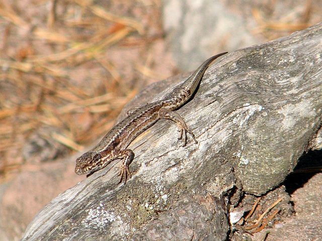 hour later we arrive at today's main attraction: the ruin Altdahn. It has been constructed over centuries in three different phases which resulted in its impressive extent. What is left today is still complex enough its structure cannot be grasped immediately. This is surely true even more for children which explains why there are so many climbing up and down the stairs excitedly. The rest of the tour is quickly old: down to Erfweiler and up again onto a might rock to look down on Erfweiler and back to Altdahn. No matter which rock and what views it offers, on and in each of them wall lizards seem to feel very comfortable. Next down again and up again onto a mighty rock which – judged by the number of ropes hanging over the cliff - seems to offer great climbing opportunities. Then down again passing Schindhard and heading straight for Reichenhard to not miss the Esslinger that goes straight back to Karlsruhe main station – with a really moderate pace.
Clear view: 3/5
Nature: 3/5
Culture: 3/5
From Bad Dürkheim to Neustadt
At the right time on the Pfälzer Mandelpfad 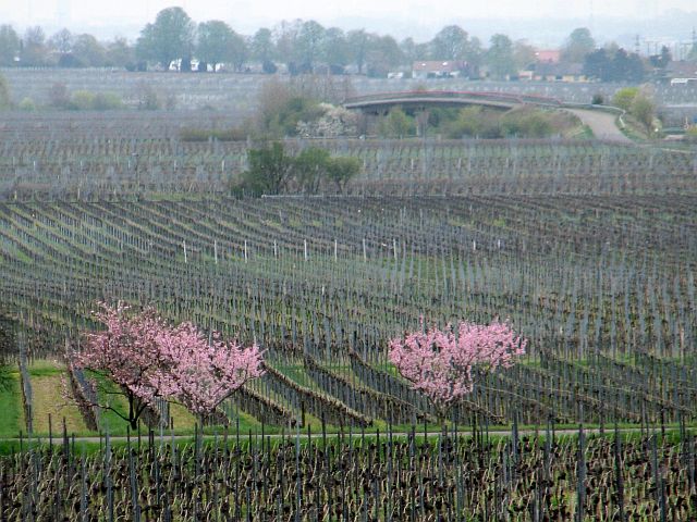 (Palatinate Almond Path). Almonds flourish in Europe mainly south of the Alpes. Typically they are considered to be “Mediterranean”. However, the climate in the Upper Rhine Valley at many spots comes close to a Northern Mediterranean one. It is speculated that already the Romans brought the Almond tree into the region and grew it. The Almond blossoms for about two or three weeks in March or April. A number of Palatinate villages hold celebrations on that occasion and the authorities did not pass out one more chance to create a trail on that topic. The Mandelpfad closely intermingles with the Wanderweg Weinstraße and the Weinsteig. All three lead along the edge between the flat Upper Rhine Valley and the
 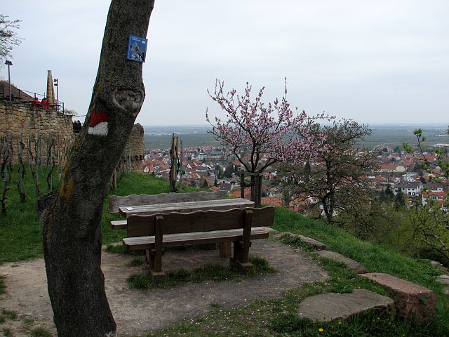 hilly Palatinate Forest. It is not only a modern phenomenon that trails and roads lead along the edge between sylvan hills and the valley. The hills never have been comfortable for traveling and much larger parts of the valley than today formerly were swampy. So in Celtic and Roman times there were mainly three lines of settlements and three major roads: one at the Eastern edge of the valley (Bergstraße, Mountain Road), one directly at the river and one here at the Western edge of the valley (Weinstraße, Wine Road). In and around nearly all of the settlements Celtic, Roman, Carolingian (Frankish) and further medieval remains have been found or are still visible. The first prominent one which is located directly at the Mandelpfad is castle Wachtenburg where it is too early for us to accept the offer to eat and drink something.
 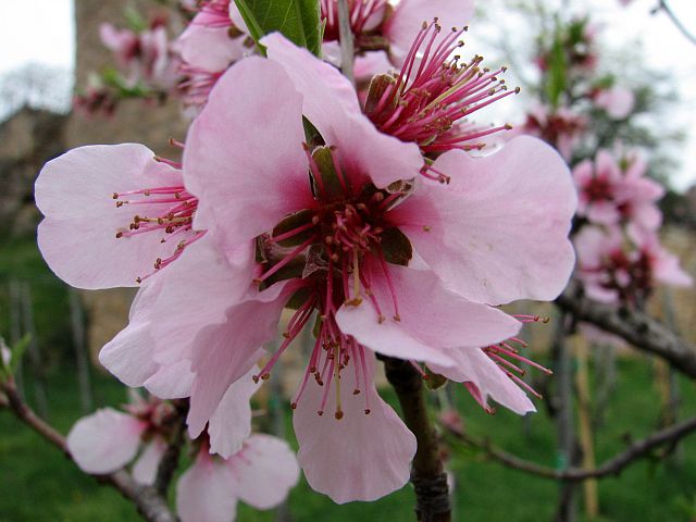 Here as well as at any other spot where the trail leads only just a bit up the hills one has a very good view over the Rhine valley. One such spot is occupied by a restaurant which drew its name from the location: “Pfalzblick”. Once more it shows that in Palatinate hunger as a phenomenon is fought as thoroughly as at not many other regions of the world. With the boundary of Königsbach we reach the outskirts of Neustadt. Gimmeldingen – nowadays another part of Neustadt and one of the settlements which celebrate the almond flourish exhaustively – is a pretty village. So is also the center of Neustadt where – different than in Gimmeldingen – there are many houses where it is obvious that some private man, some monarch or a state wanted to express his or its wealth and power.
Clear view: 3/5
Nature: 3/5
Culture: 3/5
Around Weinbiet
This is round trip over the summit of the 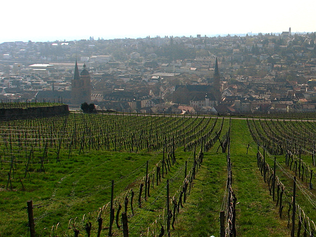 Weinbiet, a hill right next to Neustadt at whose station the tour starts and ends. From the station first we walk towards and through the center of Neustadt. Soon thereafter we gain the first meters of elevation via Schanzenweg and Haardter Treppenweg. Turning first left and then right we pass a vineyard and then walk into a conifer dominated forest. For more than 2 km the
 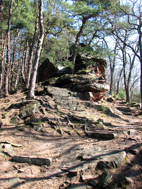 path remains at a south-facing hang and in the forest which – at least at the time we were there – gave a very characteristic experience with the intense smell of the conifers, air feeling at least 5 degree warmer than anywhere else at that day, and reddish-brown rocks under dark-green and brown trees in an almost painfully bright light. In this way we reach the ruin of castle Wolfsburg our today's western turning point. After a rest and having explored the Wolfsburg we change to the back side of the hill rising 100 m along just 500 m. A short time later we reach the Bergstein which offers a clear view over Neustadt
 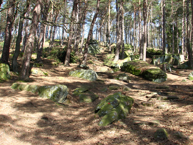 and the Upper Rhine Valley. Continuing on the – flat – ridge of the Weinbiet we climb on its summit where there is – of course – a restaurant; perfect as it is lunch time. A summit is defined by the fact that from there all paths go downhill. We choose the one towards the valley of the Mußbach, a small creek. We follow the Mußbach and by that leave the Haardt at Gimmeldingen, but go quickly back into the hills and after four more km in the woods return to Neustadt.
Clear view: 3/5
Nature: 4/5
Culture: 2/5